|
Matanzas Inlet - Southern St. Johns County, Florida |
||
|
|
||
|
Matanzas Inlet 180-degree Panoramic View From Atop Fort Matanzas |
||
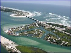
 Matanzas Inlet in southern St. Johns County is about 50 miles south of
Jacksonville,14 miles south of St.
Augustine and three miles north of "Marineland." It is one of the
few remaining
"inlets" in northeast Florida not protected by a jetty
thus presenting an easy study of what an inlet might have looked like in the past.
Because of this lack of protection, the inlet is in a constant state of
flux and may change considerably in a relatively short period of time.
Today's inlet (spanned by a modern bridge on State Road A1A) is
significantly south of the inlet which existed in 1740 when
the Spanish began construction of
Ft. Matanzas
on Rattlesnake Island to protect the
southern approach via the Matanzas River to their "Castillo de san
Marcos" in St. Augustine.
 |
||
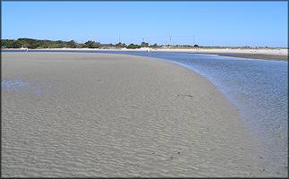
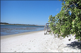
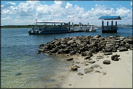
| Discussion: The Matanzas Inlet area is bordered on the north by the "Fort Matanzas National Monument" of the National Park Service | St. Johns County public land, and on the south by private land owners. Access to both the Matanzas River and the beach both north and south of the inlet should not present a problem during most times of the year. | ||
| Shelling: While this area has not provided any stunning finds over the past few years, there are records going back some 30 years documenting the presence of both an "albino" population of Triplofusus giganteus (Kiener, 1840) (Florida Horse Conch) and unusual colored variants of Cinctura hunteria (G. Perry, 1811) (Eastern Banded Tulip) here - both coveted by collectors. Additionally, the area is at the very northern end of the range of Melongena corona (Gmelin, 1791) (Crown Conch) and crabbed specimens have been found at the mouth of nearby Pellicer Creek as well as on National Park Service property. | ||


